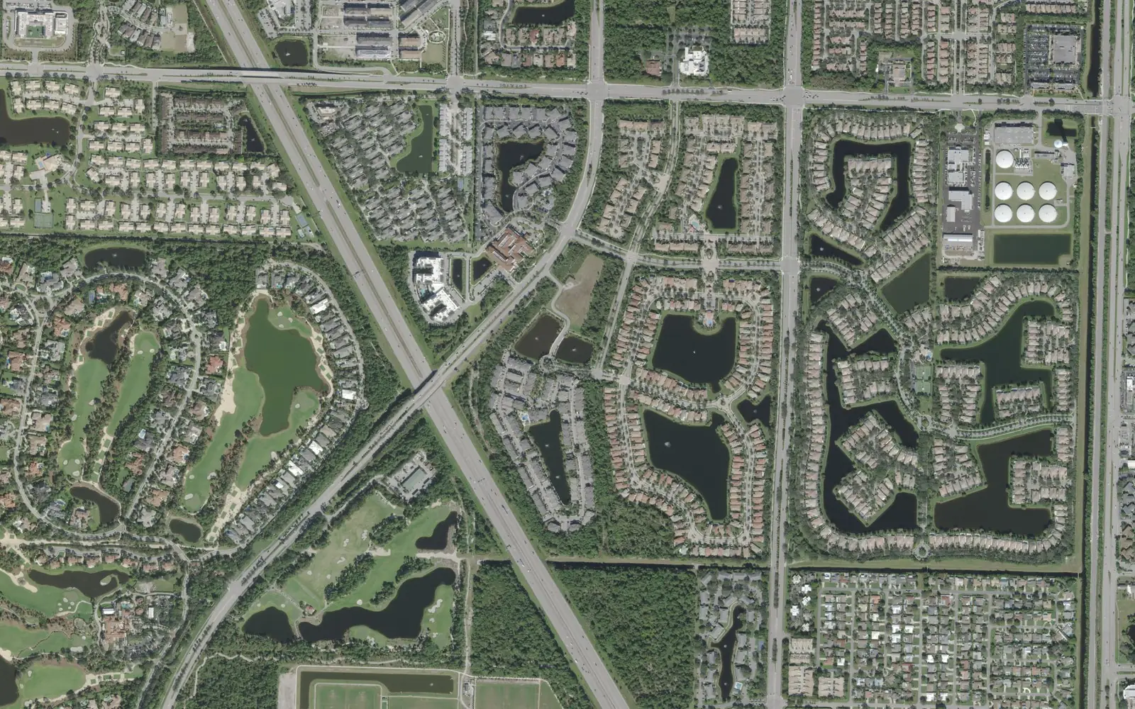
About 5,400 homes, most of them townhouses, apartments and condos, fill the area between PGA Boulevard and Donald Ross Road west of Military Trail.
Last checked Oct. 10, 2026. Sources: the City of Palm Beach Gardens’ GIS subdivision, neighborhood, address and park layers and its District Park page, Palm Beach County’s school zone open data, the Florida Department of Education’s 2026 school grades, the Zillow Home Value Index (Zillow Research), Palm Tran and © OpenStreetMap contributors.
The land between PGA Boulevard and Donald Ross Road, west of Military Trail, is the city’s busiest mix of homes outside the golf communities. The city’s address layer lists about 5,400 residential addresses here, all in ZIP code 33418, spread over about 20 named neighborhoods. Central Boulevard and Hood Road are the roads that tie it together.
What this means for you
- High school: William T. Dwyer High for about 65% of homes, mostly north of District Park (grade A in 2026); Palm Beach Gardens High for the rest, near PGA Boulevard (grade C).
- Home value: $730,715 in ZIP code 33418 in August 2026, according to the Zillow Home Value Index.
- Nearest highway exit: Florida’s Turnpike exit 109 (PGA Boulevard), about 2.7 miles by road; I-95 exit 83 (Donald Ross Road), about 3.2 miles.
Part of our Palm Beach Gardens neighborhoods guide.
Where it is
This page covers the city’s neighborhoods north of PGA Boulevard between Florida’s Turnpike and Military Trail, up to Donald Ross Road, leaving out Mirasol and Alton, which have their own pages. I-95 crosses the area diagonally. The largest named neighborhoods on the city’s layers are:
- Old Palm, a 665-acre golf community with about 370 homes, near PGA Boulevard.
- Garden Lakes (about 590 townhouses), Hampton Cay, Gardens of Woodberry, Bent Tree and Shady Lakes, just north of PGA Boulevard.
- Westwood Gardens and Westwood Lakes (about 700 townhouses together), Paloma, Trevi and Central Gardens, around Hood Road.
- Fiore, Magnolia Bay, San Michele, Legends at the Gardens and Donald Ross Village, toward Donald Ross Road.
On the city’s address layer, 43% of the area’s residential addresses are townhouses, 19% are single-family houses, 17% are apartments and 16% are condos. The city marks about half as inside a gated community.
Schools
From Palm Beach County’s open data copy of the School District of Palm Beach County’s attendance zones, matched to every residential address:
| Level | Zoned school | Share of addresses | Florida 2026 grade |
|---|---|---|---|
| Elementary | Timber Trace Elementary | 71% | A |
| Elementary | Marsh Pointe Elementary | 29%, including Westwood Gardens, Fiore, Magnolia Bay and Legends | A |
| Middle | Watson B. Duncan Middle | 100% | B |
| High | William T. Dwyer High | 65% | A |
| High | Palm Beach Gardens High | 35%, including Garden Lakes and most of Old Palm | C |
Each name links to the school’s state report card. Timber Trace Elementary and Duncan Middle are inside the area, at 5200 and 5150 117th Court N., according to the federal school directory. Because the area is split, check every address on the district’s Find My School map. More in our schools guide.
Home values
The typical home value in ZIP code 33418 was $730,715 in August 2026, up 3.8% from $703,836 in August 2025. Zillow’s figure for Palm Beach Gardens as a whole was $695,799, up 3.2%. The Zillow Home Value Index is a modeled typical value for the middle third of homes, single-family houses and condos together, not a sale price. It covers the whole ZIP code, including the large golf communities, so it says little about the townhouses and apartments that make up much of this area. More in our home prices guide.
Parks and trails
The city’s main sports parks are here, along 117th Court North:
- Gardens North County District Park, 5101 117th Court N.: about 82 acres with eight soccer fields, pavilions, a jogging path, a bike path and a nature trail. The city says its splash pad and playgrounds are free and open daily.
- Joseph R. Russo Athletic Complex: four tennis courts, six pickleball courts, two basketball courts, a playground, a pavilion and a nature trail, on the city’s park layer.
- Tennis and Pickleball Center: 18 tennis courts on the city’s park layer.
More in our parks and trails guide.
Getting around
- Florida’s Turnpike: exit 109 (PGA Boulevard), about 2.7 miles by road.
- I-95: exit 83 (Donald Ross Road), about 3.2 miles; exit 79 (PGA Boulevard), about 3.4 miles.
- City Hall (10500 N. Military Trail): about 2.7 miles.
- President Donald J. Trump International Airport (PBI): about 14.1 miles.
- These are distances measured on the OpenStreetMap road network with the OSRM routing engine from the middle of the area, not drive times.
- Bus: Palm Tran’s current schedule data shows eight stops on Route 10 (Gardens Mall to Jupiter via Military Trail) within a quarter mile of the area’s homes.
More in our getting around guide.
Groceries and everyday stores
OpenStreetMap lists a Publix at 10913 N. Military Trail and a CVS Pharmacy at 11000 N. Military Trail, near PGA Boulevard, and a Publix at 5500 Military Trail with a CVS Pharmacy at Donald Ross Road and North Military Trail at the north end.
How we drew this area
This page groups the residential neighborhoods in the City of Palm Beach Gardens’ subdivision and neighborhood layers that lie north of PGA Boulevard between Florida’s Turnpike and Military Trail, outside Mirasol and Alton. The city does not name this area as a whole; we named it for its main roads. Home counts, home types, gates and ZIP codes come from the city’s address layer on Oct. 10, 2026, counting residential addresses. Each address was matched to Palm Beach County’s open data copy of the district’s attendance zones. Store locations and road distances use © OpenStreetMap contributors.
Frequently asked questions
What high school is the Hood Road area of Palm Beach Gardens zoned for?
Most homes north of the city’s District Park, about 65% of the area, are zoned for William T. Dwyer High; those closer to PGA Boulevard are zoned for Palm Beach Gardens High, in Palm Beach County’s copy of the district’s zones.
What ZIP code is Central Boulevard in Palm Beach Gardens?
- Every residential address in the area on the City of Palm Beach Gardens’ address layer is in ZIP code 33418.
Is Old Palm in Palm Beach Gardens?
Yes. The city’s subdivision layer lists Old Palm at 665 acres, with about 370 residential addresses, all in ZIP code 33418.
Is the Central Boulevard area a good place to live?
Here are the facts. The area has about 5,400 homes, 43% of them townhouses, plus the city’s 82-acre District Park and tennis center, and Palm Tran Route 10 stops on Military Trail. The typical home value in ZIP code 33418 was $730,715 in August 2026, according to Zillow.
Have your say