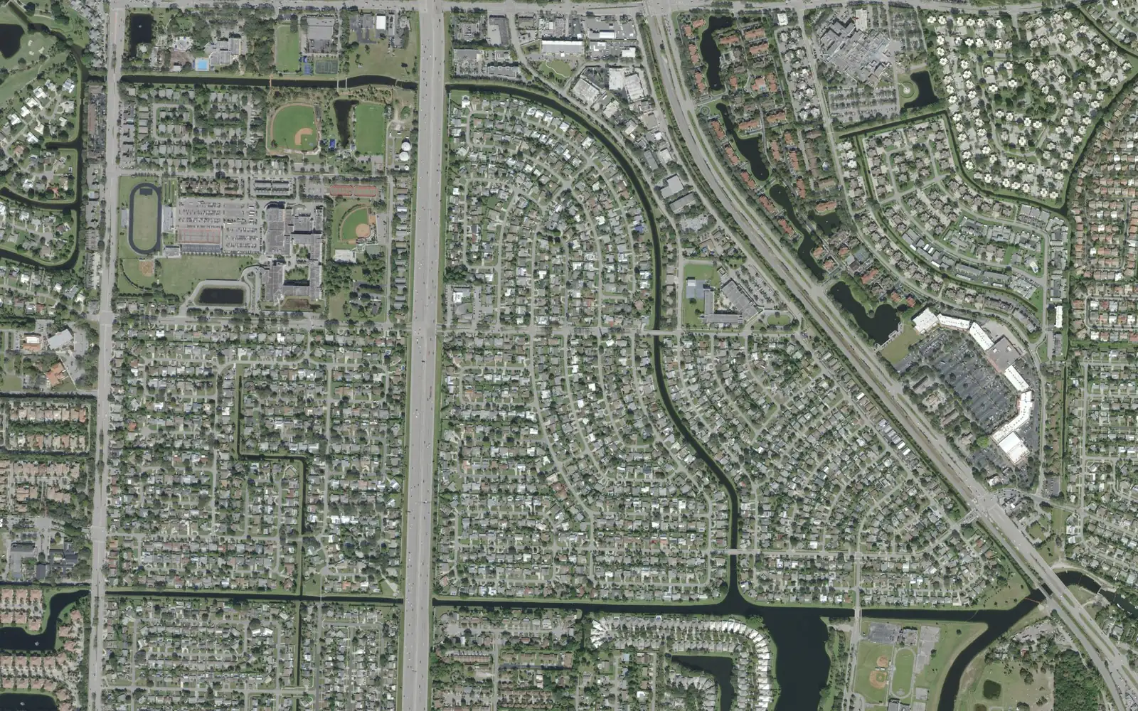
The city's original plats around Burns Road and Holly Drive hold about 4,800 homes, all zoned for Palm Beach Gardens High, and most city parks.
Last checked Oct. 10, 2026. Sources: the City of Palm Beach Gardens’ GIS neighborhood, address and park layers and its Comprehensive Plan, Palm Beach County’s school zone open data, the Florida Department of Education’s 2026 school grades, the Zillow Home Value Index (Zillow Research), Palm Tran and © OpenStreetMap contributors.
South of PGA Boulevard and north of Northlake Boulevard, around Burns Road and Holly Drive, are the blocks of homes that the city’s neighborhood layer still names by their original plat numbers: Plat 1, Plat 3, Plat 5, Plat 6 and Plat 7, with Palm Beach Square and Lake Catherine beside them. City Hall, Palm Beach Gardens High and the Burns Road recreation campus are here too. The city’s address layer lists about 4,800 residential addresses in the area.
What this means for you
- High school: Palm Beach Gardens High, 4245 Holly Drive, for every address in the area. It earned a C in Florida’s 2026 grades.
- Home value: $589,714 in ZIP code 33410, which covers 60% of the area, in August 2026, according to the Zillow Home Value Index.
- Nearest highway exit: I-95 exit 79 (PGA Boulevard), about 1.9 miles by road, or exit 77 (Northlake Boulevard), about 2 miles.
Part of our Palm Beach Gardens neighborhoods guide.
Where it is
This page covers the city’s neighborhoods between PGA Boulevard and Northlake Boulevard from BallenIsles’ eastern edge to Alternate A1A, with Military Trail and I-95 running north to south through it. Burns Road and Holly Drive cross it from west to east.
- East of Military Trail: Plats 1, 3, 5, 6 and 7, Palm Beach Square, Golfers Village and the 4120 at Palm Beach Gardens apartments, with City Hall at 10500 N. Military Trail.
- Near MacArthur Boulevard: Lake Catherine, a 73-acre neighborhood of about 300 homes, and The Sutton apartments. The city’s future land use element (PDF) sets a MacArthur Boulevard Historic Overlay to protect the boulevard “as a historic gateway into the City” through its banyan trees and linear greenway.
- West of Military Trail: smaller communities such as Garden Isles, Woodland Lakes, Tamberlane, Longwood, Gardens Hunt Club and Cypress Hollow.
On the city’s address layer, 51% of the area’s residential addresses are single-family houses, 21% are apartments, 11% are condos and 10% are townhouses. The city marks only about 14% as inside a gated community, the lowest share of any area in our guide.
ZIP codes: 33410 for 60% of addresses, 33418 for 25%, mostly west of Military Trail, and 33403 for 16%, around Lake Catherine.
Schools
From Palm Beach County’s open data copy of the School District of Palm Beach County’s attendance zones, matched to every residential address:
| Level | Zoned school | Where | Florida 2026 grade |
|---|---|---|---|
| Elementary | Palm Beach Gardens Elementary | The plats, Palm Beach Square (57%) | A |
| Elementary | Timber Trace Elementary | West of Military Trail (27%) | A |
| Elementary | Allamanda Elementary | Lake Catherine, The Sutton (16%) | A |
| Middle | Howell L. Watkins Middle | Plats 1, 3, 5 and 7, Lake Catherine (38%) | C |
| Middle | Watson B. Duncan Middle | Plat 6, Palm Beach Square and west (62%) | B |
| High | Palm Beach Gardens High | All | C |
Each name links to the school’s state report card. Palm Beach Gardens Elementary (10060 Riverside Drive) and Watkins Middle (9480 MacArthur Blvd.) are inside the area, according to the federal school directory. Check any address on the district’s Find My School map. More in our schools guide.
Home values
In August 2026 the typical home value was $589,714 in ZIP code 33410, up 2.8% from $573,575 a year earlier; $730,715 in 33418, up 3.8%; and $387,485 in 33403, up 2.8%. Zillow’s figure for Palm Beach Gardens as a whole was $695,799, up 3.2%. The Zillow Home Value Index is a modeled typical value for the middle third of homes, single-family houses and condos together, not a sale price, and each figure covers a whole ZIP code. ZIP code 33403 is mostly the town of Lake Park. More in our home prices guide.
Parks and trails
Most of the city’s neighborhood parks are here, on the city’s park layer:
- Burns Road Recreation Center and Aquatic Complex, 4404 and 4420 Burns Road: pools, a splash zone, pavilions, a playground and a 0.44-mile walking trail.
- Gardens Park, off Johnson Dairy Road: eight baseball fields, including the Miracle League turf field, pavilions and playgrounds.
- Lilac Park, 4175 Lilac St., with walking trails of 0.49 and 0.98 miles, and Plant Drive Park, with 12 pickleball courts, basketball, softball and a skate park.
- Lake Catherine Lakeside Park, 9481 MacArthur Blvd.: a canoe and kayak launch, fishing and a 0.40-mile walking trail, and the Lake Catherine Sports Complex, with four softball fields.
- Smaller parks: Thompson River Linear Park, Twins Park, Lakeside Center and the South Ilex Circle Neighborhood Park.
More in our parks and trails guide and our walking and biking trails guide.
Getting around
- I-95: exit 79 (PGA Boulevard), about 1.9 miles by road; exit 77 (Northlake Boulevard), about 2 miles.
- Florida’s Turnpike: exit 109 (PGA Boulevard), about 3.3 miles.
- City Hall (10500 N. Military Trail): about 1.3 miles.
- President Donald J. Trump International Airport (PBI): about 11.4 miles.
- These are distances measured on the OpenStreetMap road network with the OSRM routing engine from the middle of the area, not drive times.
- Bus: Palm Tran’s current schedule data shows 31 stops on Route 33 (Gardens Mall to Cross County Plaza) and 18 on Route 3 (Military Trail to Boca Raton) within a quarter mile of the area’s homes.
More in our getting around guide.
Groceries and everyday stores
OpenStreetMap lists Publix stores at 10913 N. Military Trail, near PGA Boulevard; at 9900 Alternate A1A; and at 4200 Northlake Blvd. It also lists a Winn-Dixie at 8924 N. Military Trail, a Walgreens at 3063 Northlake Blvd. and a CVS Pharmacy at Northlake Boulevard and North Military Trail.
How we drew this area
This page groups the residential neighborhoods in the City of Palm Beach Gardens’ neighborhood layer that lie between PGA Boulevard and Northlake Boulevard, east of BallenIsles and west of Alternate A1A, outside the Regional Center. The city does not name this area as a whole; we named it for its main roads. Home counts, home types, gates and ZIP codes come from the city’s address layer on Oct. 10, 2026, counting residential addresses. Each address was matched to Palm Beach County’s open data copy of the district’s attendance zones. Store locations and road distances use © OpenStreetMap contributors.
Frequently asked questions
What high school is the Burns Road area zoned for?
Palm Beach Gardens High, at 4245 Holly Drive, for every residential address in the area in Palm Beach County’s copy of the district’s zones. It earned a C in Florida’s 2026 school grades.
What are the Plats in Palm Beach Gardens?
Plat 1, Plat 3, Plat 4, Plat 5, Plat 6 and Plat 7 are the names the City of Palm Beach Gardens’ neighborhood layer gives some of its oldest blocks of homes, most of them single-family houses between Military Trail and Alternate A1A.
Is the Burns Road area a good place to live?
Here are the facts. The area has about 4,800 homes, about half of them single-family houses, City Hall, the Burns Road recreation campus and more than a dozen city parks. The typical home value in ZIP code 33410, which covers most of it, was $589,714 in August 2026, according to Zillow.
What ZIP codes are in the Burns Road area?
Mostly 33410. On the city’s address layer, 60% of the area’s addresses are in 33410, 25% in 33418, west of Military Trail, and 16% in 33403, near Lake Catherine.
Have your say