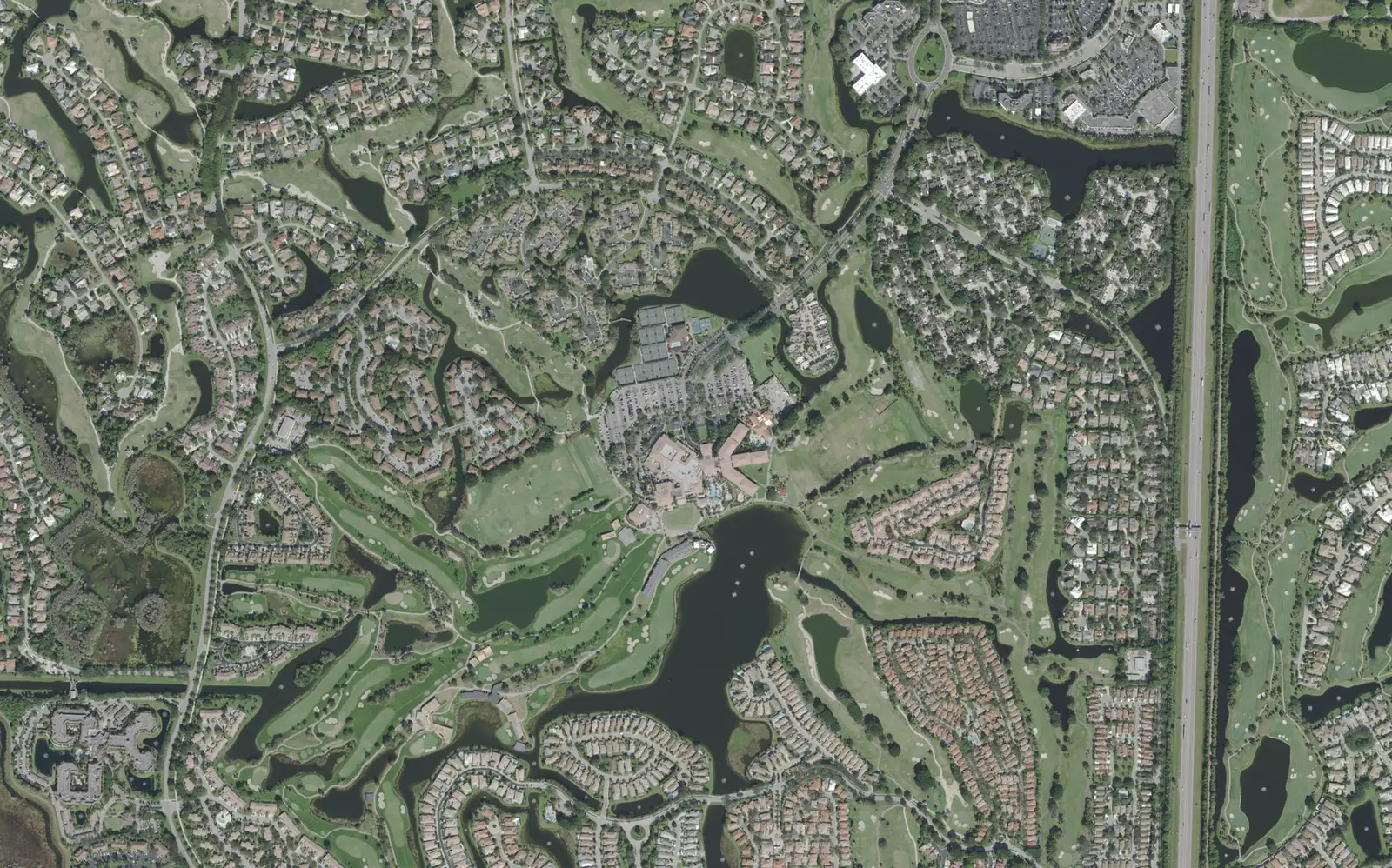
PGA National covers 2,332 acres south of PGA Boulevard with about 5,400 homes, all in ZIP code 33418 and zoned for Palm Beach Gardens High School.
Last checked Oct. 10, 2026. Sources: the City of Palm Beach Gardens’ GIS subdivision, neighborhood, address and park layers, Palm Beach County’s school zone open data, the Florida Department of Education’s 2026 school grades, the Zillow Home Value Index (Zillow Research), Palm Tran and © OpenStreetMap contributors.
PGA National is the largest block of homes in Palm Beach Gardens. The city’s subdivision layer puts it at 2,332 acres, and its address layer lists about 5,400 residential addresses there, all in ZIP code 33418. The city’s neighborhood layer divides it into 51 named neighborhoods.
What this means for you
- High school: Palm Beach Gardens High, for every PGA National address. It earned a C in Florida’s 2026 grades.
- Home value: $730,715 in ZIP code 33418 in August 2026, according to the Zillow Home Value Index.
- Nearest highway exit: Florida’s Turnpike exit 109 (PGA Boulevard), about 3.2 miles by road from the middle of the community.
Part of our Palm Beach Gardens neighborhoods guide.
Where it is
PGA National sits south of PGA Boulevard and west of Florida’s Turnpike, with the Beeline Highway (State Road 710) along its southwest side. PGA Boulevard is its northern edge and main way in and out. The community wraps around golf courses and lakes, as the aerial photo shows.
Homes are a mix. On the city’s address layer, 44% of PGA National’s residential addresses are single-family houses, 30% are townhouses and 17% are condos; about 6% are units in an assisted living community. The city marks every one of them as inside a gated community.
Schools
From Palm Beach County’s open data copy of the School District of Palm Beach County’s attendance zones, matched to every residential address:
| Level | Zoned school | Share of PGA National addresses | Florida 2026 grade |
|---|---|---|---|
| Elementary | Timber Trace Elementary | 100% | A |
| Middle | Watson B. Duncan Middle | 100% | B |
| High | Palm Beach Gardens High | 100% | C |
Each name links to the school’s state report card. Zones change, so check any address on the district’s Find My School map. More in our schools guide.
Home values
The typical home value in ZIP code 33418 was $730,715 in August 2026, up 3.8% from $703,836 in August 2025. Zillow’s figure for Palm Beach Gardens as a whole was $695,799, up 3.2%. The Zillow Home Value Index is a modeled typical value for the middle third of homes, single-family houses and condos together, not a sale price. It covers the whole ZIP code, which also takes in Mirasol, BallenIsles and Alton. More in our home prices guide.
Parks and trails
From the city’s park layer:
- PGA National Park, on Hiatt Drive at the community’s south side: about 35 acres with two tennis courts, three basketball courts, two softball fields, three multipurpose fields, two pavilions, a playground, a bike path and lake fishing with a boat ramp.
- Sandhill Crane Access Park, on PGA Boulevard west of the community: a 1-acre access point with fishing, a boat ramp and a nature trail.
More in our parks and trails guide and our walking and biking trails guide.
Getting around
- Florida’s Turnpike: exit 109 (PGA Boulevard), about 3.2 miles by road.
- I-95: exit 77 (Northlake Boulevard), about 4.2 miles; exit 79 (PGA Boulevard), about 4.7 miles.
- City Hall (10500 N. Military Trail): about 4.8 miles.
- President Donald J. Trump International Airport (PBI): about 12.8 miles.
- These are distances measured on the OpenStreetMap road network with the OSRM routing engine from the middle of the community, not drive times.
- Bus: Palm Tran’s current schedule data shows no stops within a quarter mile of PGA National’s homes. The nearest service is on Military Trail; see Palm Tran’s route pages.
More in our getting around guide.
Groceries and everyday stores
OpenStreetMap lists no supermarket or pharmacy inside PGA National. The nearest it maps are the Publix at 6251 PGA Blvd. and the Walgreens at PGA Boulevard and North Jog Road, each about 2.7 miles by road from the middle of the community, and the Winn-Dixie at 8924 N. Military Trail, about 3.8 miles.
How we drew this area
This page follows the PGA National boundary in the City of Palm Beach Gardens’ subdivision layer. Home counts, home types, gates and ZIP codes come from the city’s address layer on Oct. 10, 2026, counting residential addresses, which include assisted living units. Each address was matched to Palm Beach County’s open data copy of the district’s attendance zones. Store locations and road distances use © OpenStreetMap contributors.
Frequently asked questions
What ZIP code is PGA National in?
- Every residential address in PGA National on the City of Palm Beach Gardens’ address layer is in ZIP code 33418.
What schools is PGA National zoned for?
Timber Trace Elementary, Watson B. Duncan Middle and Palm Beach Gardens High, in Palm Beach County’s copy of the district’s zones. In Florida’s 2026 school grades they earned an A, a B and a C.
Is PGA National a good place to live?
Here are the facts. PGA National is a 2,332-acre community of about 5,400 homes, 44% of them single-family houses, with PGA National Park on its south side. The typical home value in ZIP code 33418 was $730,715 in August 2026, according to Zillow.
Is PGA National gated?
The city’s address layer marks all of PGA National’s residential addresses as inside a gated community.
Have your say